Atlas of the Historical Geography of the United States
by Charles O. Paullin and John K. Wright
see dsl.richmond.edu/historicalatlas/

A map of lived experience?

What about people in maps?

In 1970 Torsten Hägerstrand asks “What about people in regional science?”

Hägerstrand T. 1970. What About People in Regional Science? Papers in Regional Science.24(1) 7-24.

Population approaches to geography miss key aspects of lived experience

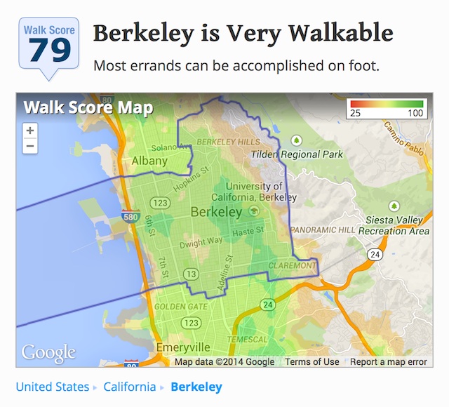
source mapnificent.net

source walkscore.com

Hägerstrand, in time geography proposed conceptual tools for thinking about geography of lives as they are lived in an analytical way

pond near Japanese National Museum, Tokyo, 2012

Many approaches emphasize choices available

Time geography emphasizes constraints

visualization of gaps between prime numbers
source digitalnoah.com

The
indivisible
individual

construction of Hoover Dam Bridge
photography by Jamey Stillings

Goals

Tasks

Projects

overpacked bicycle Guangzhou, China
picture by Andreas Norman

Packing
constraints

blue plaque in London
commemorating
inventor of time travel
thestateofthenationuk.
blogspot.com

Movement
  takes
   time

Taken together, these axioms constrain where it is feasible for an individual to be at a given time, in three ways

Capability

Coupling

Authority

Life as it is lived is a product of individuals negotiating these constraints

The Georgia Aquarium
image by Zac Wolf, source
commons.wikimedia.org

Tools and applications

Space-time aquarium

From Dijst 2009, reprinted from Thrift NJ. 1977.An Introduction to Time-Geography Norwich, UK, Geo Abstracts.

Space-time prism

From Dijst 2009, reprinted from Lenntorp B. 1976. Paths in space-time environment: A time geographic study of movement possibilities of individuals. Lund Studies in Geography Series B, Human Geography 44.


Start and end locations and times, and transport available give forward and backward cones in space-time

Projection of their intersection onto two dimensions gives accessible locations


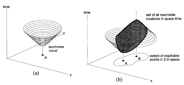
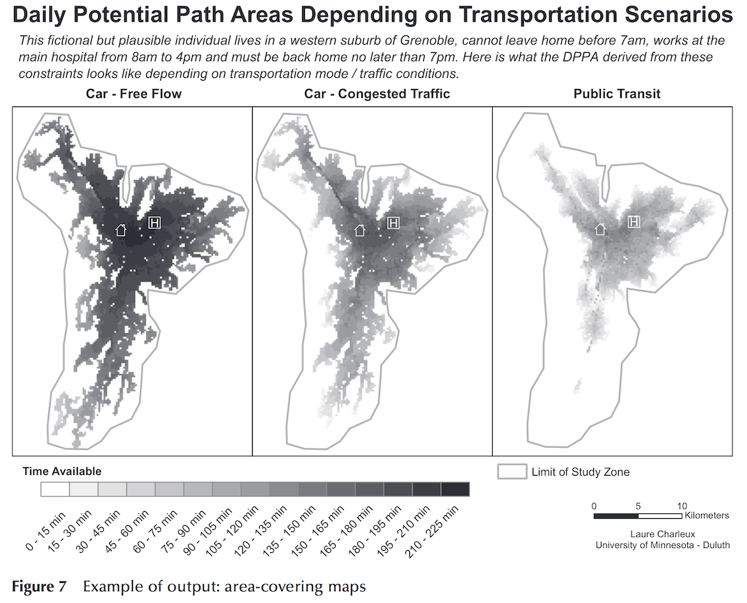
From O’Sullivan D, A Morrison, J Shearer. 2000. Using desktop GIS for the investigation of accessibility by public transport: an isochrone approach. International Journal of Geographical Information Science 14(1), 85-104.

Kwan M-P. 2000. Interactive geovisualization of activity-travel patterns using three-dimensional geographical information systems: a methodological exploration with a large data set. Transportation Research Part C: Emerging Technologies. 8(1-6), 185-203.
From Charleux L. 2014. A GIS toolbox for measuring and mapping person-based space-time accessibility. Transactions in GIS. 19(2), 252-268.

Okinawa Churaumi Aquarium Okinawa Aquarium

Summary

Time geography attends to the details of individual lives

Provides a framework for thinking about mobility and accessibility

Highly relevant to today’s location-enabled world

How communications technologies alter the framework is an interesting question